
Today, we're going on a trek to Mt. Tateyama before the snow starts to melt away.
The actual name is called: Tateyama Kurobe Alpine/Alpen.
- The Tateyama Kurobe Alpine Route (館山黒部アルペンルート, Tateyama Kurobe Alpen Route) is a unique and spectacular route through the Northern Japan Alps which is traversed by various means of transportation including cablecars, trolley buses and a ropeway. Completed in 1971, the route connects Toyama City in Toyama Prefecture with Omachi Town in Nagano Prefecture.
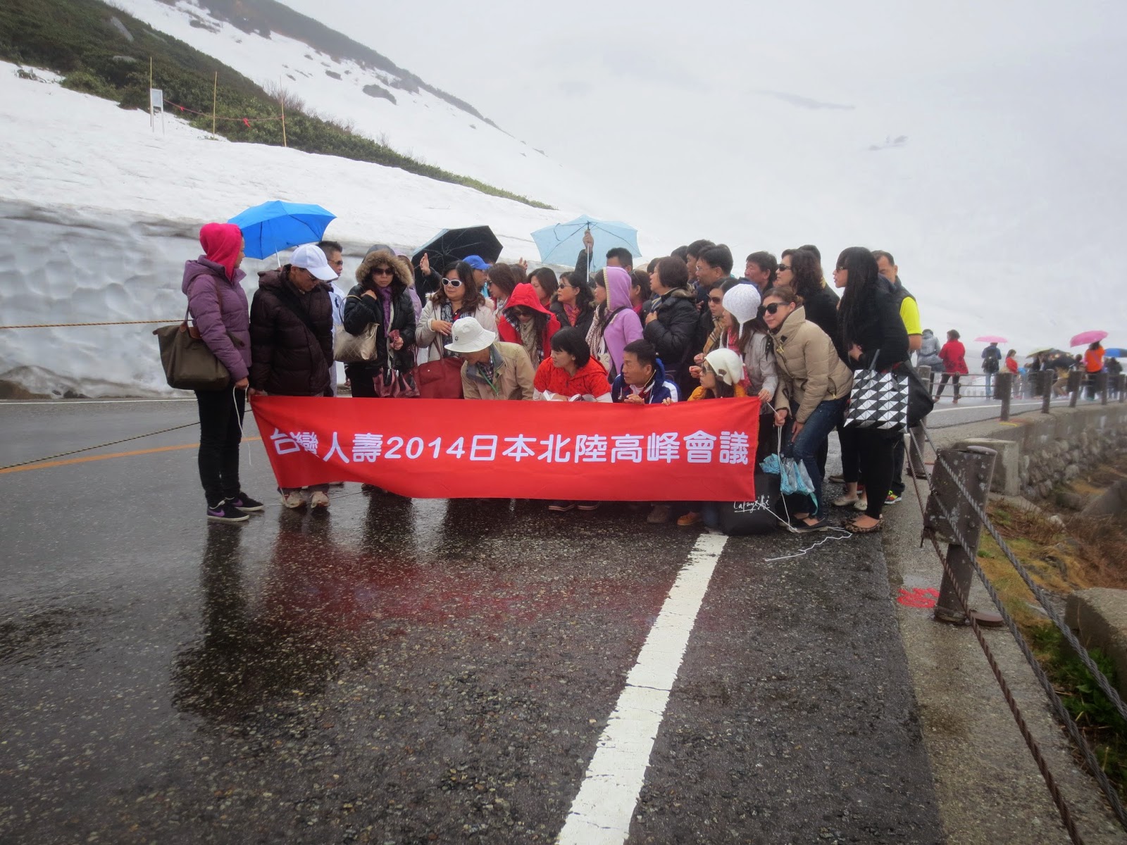
The main attraction of the Tateyama Kurobe Alpine Route is the magnificent scenery of the Tateyama Mountain Range, part of the Chubu Sangaku National Park. Visitors can enjoy varying vistas during different seasons of the year. In spring, accumulated snow, especially around the upper sections of Midagahara and Murodo, form a majestic snow corridor whose snow walls reach up to 20 meters high. A section of the snow corridor around Murodo is open to pedestrians usually from mid April to mid June. In 2014, the snow corridor is open to pedestrians from April 16 to June 22.
~~~~~~~~~~~~~~~~~~~~~~~~~~~~~~~~~~~~~~~~~~~~~~~~~~~~~~~~~~~~~~~~~~~~~~~~~~
We went on June 12, so it's like 10 days before they close =X

Located at the right side of the station if you walked out from the platform.
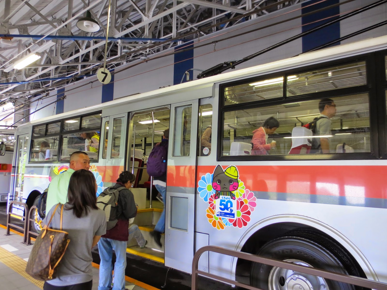
Bus ticket could be obtained at a booth outside the station on the left when you stepped out.


We only got to the fifth station, by the time we reached to the top it's about 12plus Japan time. And we get take the bus down as our luggage were still kept at Shinano station.


Time is super important to Japanese and even if you're late for 1 minute, you will have to board the next train/bus/ship.
So BETTER NOT BE LATE!!!!
I've placed the pictures according to Tateyama Kurobe Alpen Route.
Do not get confused
Starting from here, we will be going up to reach the Mt. Tateyama


The above 3 are real-time weather conditions at various stops while reaching to the top.
Considering Ogizawa is the first station.


2nd station, by foot or we will call it the bus '11' as 11 looks like a pair of legs.


You will need to walk on the dam to get to the other side where another station is situated.


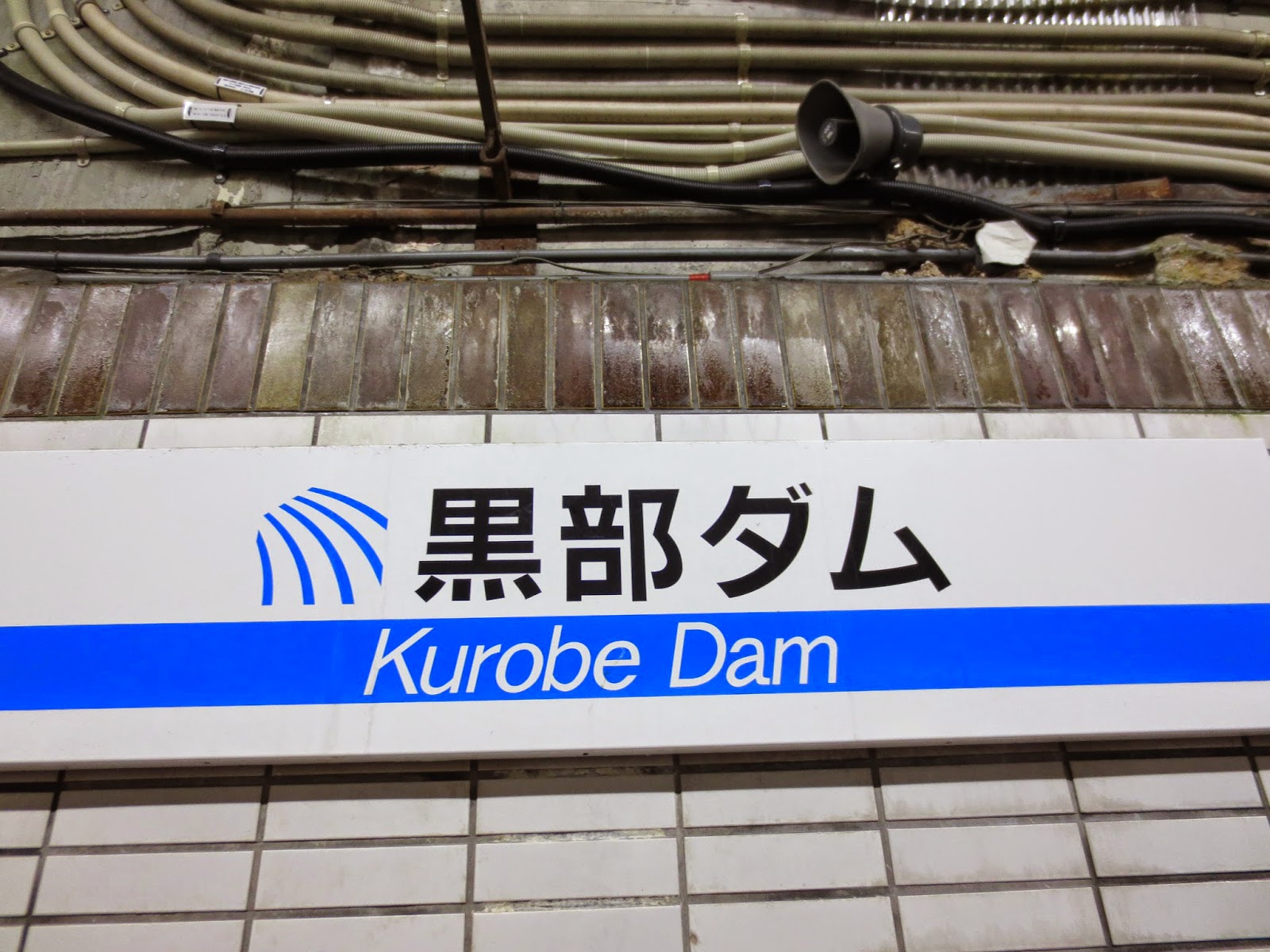
3rd station - Kurobedaira 黑部平


One final stop before we reached the top.


WE FINALLY MADE IT TO MT. TATEYAMA.


The snow is slowly melting.


Going back home after a tiring day. We woke up at 6am and had arranged breakfast for 7am and have to leave the pension at 8am least 8.15am else we're not able to catch the train and do all these throughout the entire day.
Time is crucial but a productive day indeed.


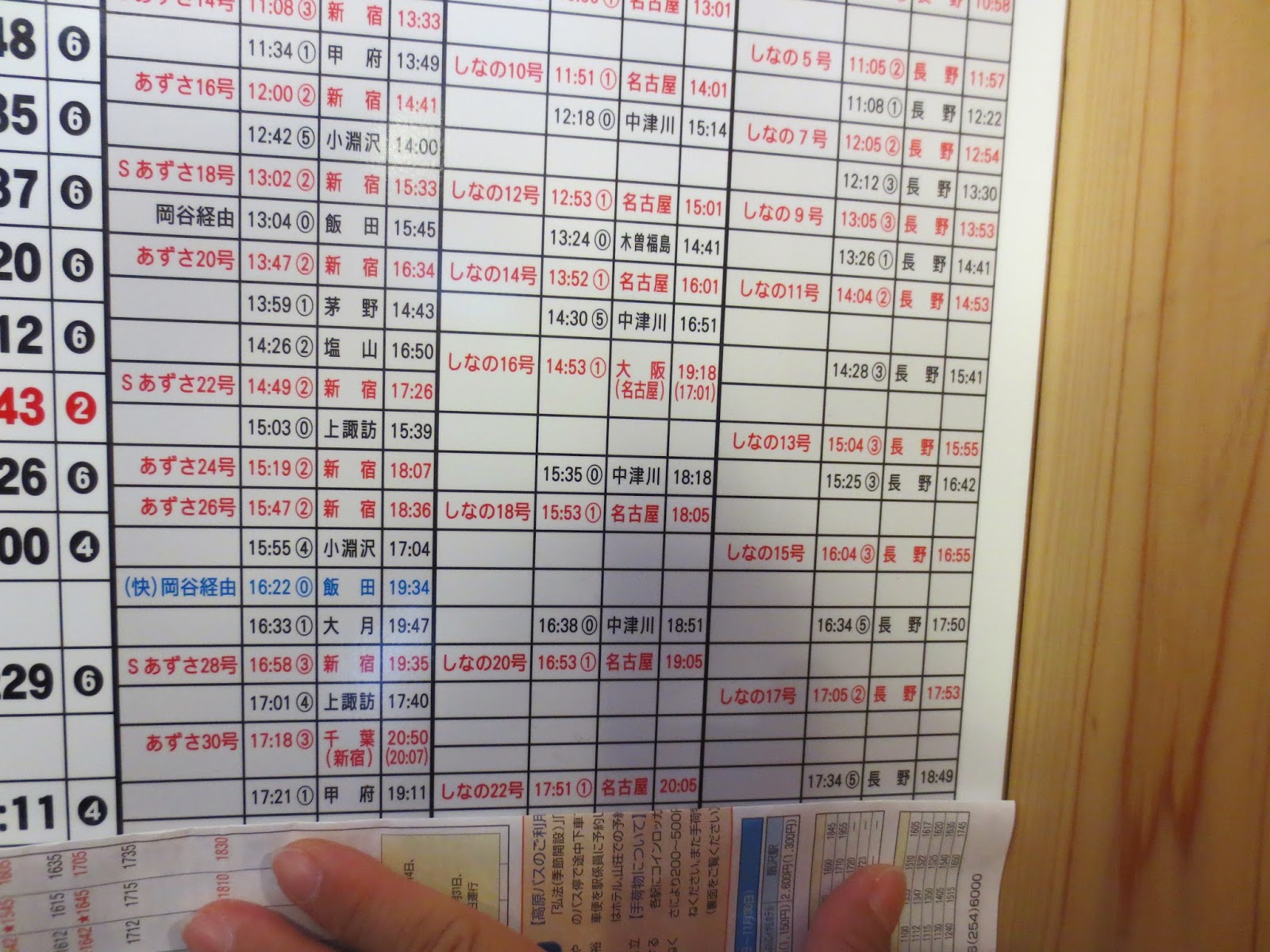
Do make sure to look at the timetable carefully as we didn't read the instructions properly.
We thought we're able to catch the 3.30pm bus but, turns out, it's only available for a certain period which was highlighted in blue.


Our journey doesn't end here but due to the length, i will have to separate into 3 parts.
Check out my Kyoto Travelogue:
Day 1
Day 2&3
End of Day 3 and Start of Day 4 ~ Part 1
Day 4 ~ Part 3 and Final Day in Kyoto